

| Governing Standard | MUTCD (Manual on Uniform Traffic Control Devices) (Federal Highway Administration) |
| Number of Standard Sign Colors | 8 (including fluorescent yellow-green) (MUTCD, current edition) |
| Shape Reserved Exclusively for Stop | Octagon (MUTCD) |
| Color for Active Work Zones | Orange (MUTCD) |
| Color for Motorist Services | Blue (MUTCD) |
| Shape for School Zones | Pentagon (point up) (MUTCD) |
Why Sign Literacy Matters Behind the Wheel
Most drivers pass hundreds of highway signs every hour without consciously reading all of them - and that's exactly how the system is designed. U.S. road signs use a standardized color-and-shape coding system governed by the MUTCD, published by the Federal Highway Administration. The goal is instant recognition, even at highway speed. But when a sign's meaning isn't already stored in memory, a driver can miss critical information in seconds.
This field reference breaks down the coding system so you can decode any sign you encounter - not just the ones you've memorized. Whether you're planning a cross-country drive or navigating an unfamiliar stretch of road, understanding the logic behind the signs makes you a more confident, prepared driver. See our guide to scenic routes vs. interstates for more on how road type affects your overall trip experience.
| Governing Standard | MUTCD (Manual on Uniform Traffic Control Devices) (Federal Highway Administration) |
| Number of Standard Sign Colors | 8 (including fluorescent yellow-green) (MUTCD, current edition) |
| Shape Reserved Exclusively for Stop | Octagon (MUTCD) |
| Color for Active Work Zones | Orange (MUTCD) |
| Color for Motorist Services | Blue (MUTCD) |
| Shape for School Zones | Pentagon (point up) (MUTCD) |
The Color Code: What Each Hue Communicates
Color is the fastest signal a sign sends. Here's what each standard color means:
- Green: Directional and distance information - exits, destinations, mileage markers, highway route confirmations.
- Blue: Motorist services ahead - fuel, food, lodging, hospitals, rest areas. Common on interstates.
- Brown: Recreational, cultural, or scenic areas - state parks, historic sites, scenic byways.
- Yellow: General warnings - curves, merges, pedestrian crossings, railroad crossings. Permanent hazards.
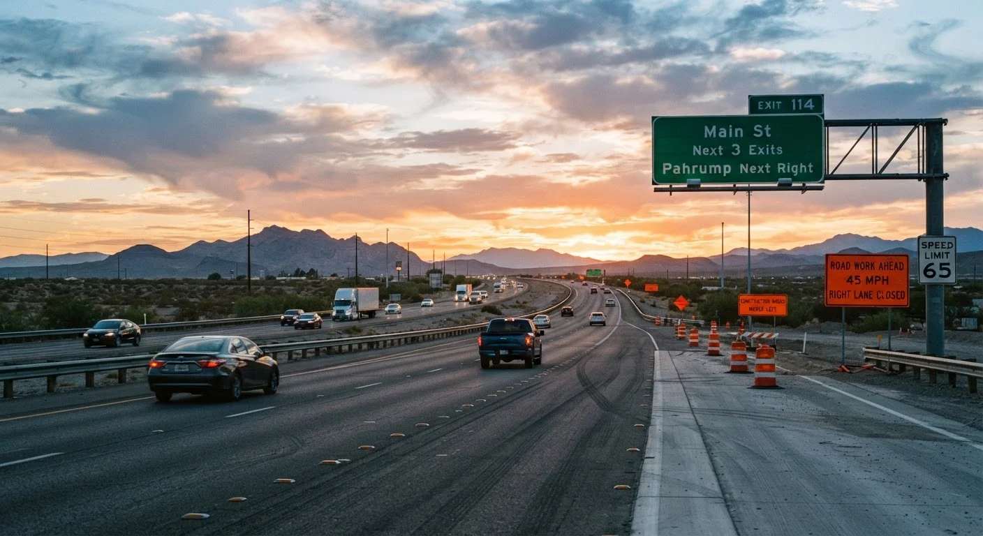
- Orange: Temporary traffic control - construction zones, detours, lane shifts. Orange means conditions ahead are actively changing.
- White: Regulatory information - speed limits, turn restrictions, lane-use rules. These signs carry legal weight.
- Red: Prohibition or mandatory stop - Stop signs, Yield signs, Do Not Enter, Wrong Way. Red always means a rule you cannot ignore.
- Fluorescent Yellow-Green: High-visibility warning for pedestrian crossings, bike routes, and school zones.
MUTCD
The Manual on Uniform Traffic Control Devices - the federal standard published by the Federal Highway Administration that defines the design, placement, and meaning of all traffic signs, signals, and pavement markings in the U.S.
Regulatory Sign
A sign that communicates a legally enforceable rule of the road, such as a speed limit or turn prohibition. Violating the instruction on a regulatory sign can result in a traffic citation.
Advisory Speed
A recommended - not legally mandated - speed for a specific road condition or feature, such as a sharp curve. Displayed on yellow plaques, it reflects the speed at which most drivers can safely navigate that condition.
Gore Area
The triangular pavement section at the divergence point of an exit ramp and the main highway. Driving through the gore area is illegal and creates significant collision risk.
Control City
A major destination city listed on green guide signs to provide directional orientation for long-distance travelers, even if many intermediate towns lie between the driver and that city.
Supplemental Plaque
A smaller sign mounted below a primary sign that adds conditions or time restrictions to the main sign's message. For example, a No Parking sign might have a plaque reading 'Mon-Fri 8 AM-6 PM.'
Shape as a Second Layer of Meaning
Even if a sign's text is obscured - by glare, weather, or a partial view - its shape still communicates meaning. The MUTCD assigns shapes deliberately:
- Octagon (8 sides): Stop - exclusively. No other sign uses this shape in the U.S.
- Triangle (inverted): Yield - give the right of way.
- Diamond: Warning - something ahead requires your attention or a speed adjustment.
- Pentagon (5 sides, point up): School zone or school crossing.
- Rectangle (vertical): Regulatory - rules and restrictions.
- Rectangle (horizontal): Guide or informational - directions, services, distances.
- Circle: Railroad advance warning or a no-passing zone marker.
- Pennant (tapered triangle, right-pointing): No passing zone - posted on the left side of the road.
Understanding shape lets you react before you can read the text - especially useful when navigating urban stops mid-road trip where signage density is high and decisions come fast.
Commonly Misread or Overlooked Signs
Several sign types cause consistent confusion even among experienced drivers:
- Advisory Speed Plaques
- A yellow diamond speed number posted below a warning sign (e.g., beneath a curve sign). This is a recommended speed for the condition - not a legal limit. Exceeding it isn't automatically a violation, but it signals genuine risk.
- Exit Gore Signs
- The small white triangle signs at the point where an exit lane separates from the main highway. Driving past this point and then cutting back across the gore area is illegal and dangerous.
- Guide Signs with Control Cities
- Green highway signs list a distant control city - not necessarily the next town - to help orient long-distance drivers. Don't assume the listed city is the very next stop.
- Supplemental Plaques
- Small rectangular signs mounted below a main sign that add conditions: "Except Buses," "7 AM-9 AM," or "When Flashing." Missing these modifiers changes the entire meaning of the sign above them.
For a broader look at how driving assumptions can create real risk, the road trip myths article covers common misbeliefs worth revisiting before a long drive.
Signs Can Vary Slightly by State
While the MUTCD sets national standards, individual states have some flexibility in supplemental sign design, wording, and local regulatory additions. What's consistent is the core color and shape system described here. Always refer to your state's driver handbook for any region-specific signs you're unfamiliar with, especially before driving in a new state.