

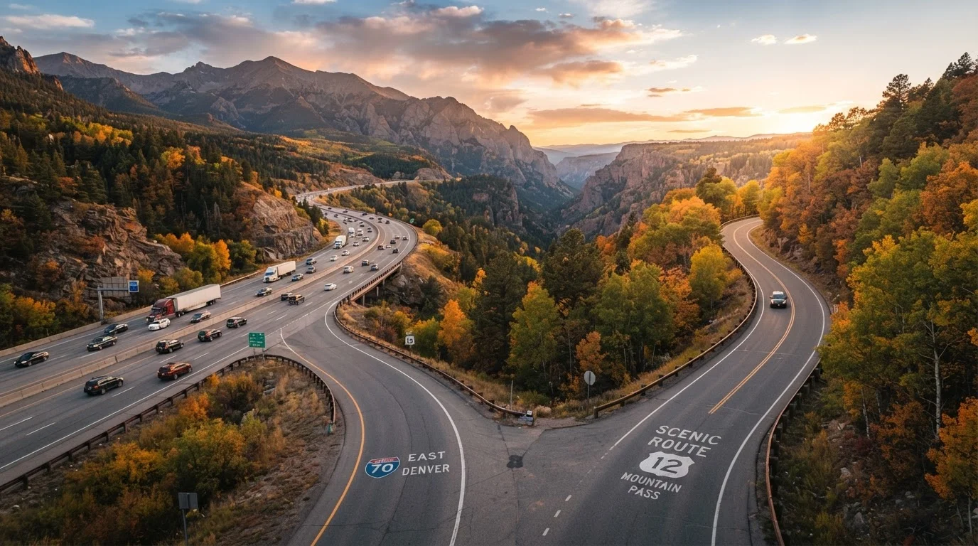
Key Takeaways
Option A
Interstate Highways
The fast, predictable backbone of American road travel.
Best for: Travelers prioritizing speed, predictability, and covering maximum distance per day.
Option B
Scenic Routes
The slower, richer path through America's most memorable landscapes.
Best for: Travelers who want discovery, cultural immersion, and the journey itself to be the destination.
If you're on a tight schedule with a firm arrival deadline
Interstate Highways
Consistent speed limits, minimal unexpected stops, and real-time traffic data make interstates far more predictable for time-sensitive travel.
If the journey itself is your primary goal
Scenic Routes
Scenic byways deliver the landscapes, roadside history, and small-town character that make a road trip memorable long after you return home.
If you're traveling with young children or pets
Interstate Highways
Frequent rest areas, predictable service stations, and faster access to medical care make interstates the lower-stress option for family travel.
If you're on an open-ended trip with flexible timing
Scenic Routes
Flexibility lets you linger at unexpected stops, explore detours, and genuinely experience the regions you're passing through.
If you want the best of both worlds
Interstate Highways
Use interstates as your primary corridor to cover ground efficiently, then branch onto scenic routes for planned highlight segments where you've researched services in advance.
What Each Route Type Actually Delivers
At their core, interstates and scenic routes represent two fundamentally different philosophies about what a road trip is for. Understanding what each delivers - and what each costs you - is the starting point for planning a trip you'll actually enjoy.
Interstate highways are engineered for throughput. Controlled access, consistent speed limits (typically 65-80 mph depending on state), well-marked exits, and standardized services every 20-40 miles create a highly predictable driving environment. You know what you're getting: distance covered efficiently, with minimal surprises.
Scenic routes - including federally designated National Scenic Byways, state-level heritage corridors, and informal back roads - are designed around the experience of the landscape itself. Speed limits drop (often to 35-55 mph), road surfaces vary, and services grow sparse. In return, you gain access to terrain, communities, and roadside history that the interstate system was deliberately built to bypass.
For a deeper look at fitting either approach into a full road trip framework, see our complete road trip planning guide.
| Criterion | Interstate Highways | Scenic Routes |
|---|---|---|
| Average speed | 65-80 mph (posted limit) | 35-55 mph, often slower |
| Fuel stop frequency | Every 20-40 miles typically | Varies widely; plan ahead |
| Cell coverage | Generally reliable | Frequent dead zones |
| Road surface consistency | High - maintained federal standard | Variable; some unpaved sections |
| Scenic and cultural value | Low - designed for efficiency | High - core purpose of the route |
| Emergency services access | Fast - frequent exits and call boxes | Slower - remote areas, limited access |
| Tolls | Common on eastern corridors | Rare to none |
| Weather sensitivity | Moderate - well-maintained in storms | High - passes and rural roads close |
Time, Fuel, and the Real Cost of Going Scenic
Scenic routes are almost always slower - and the gap is larger than most people anticipate. A mountain byway that covers 80 miles might take two and a half hours where an interstate segment of the same distance takes 70 minutes. Multiply that across multiple scenic legs and a trip's timeline can shift significantly.
Fuel consumption is also affected. Stop-and-go driving through mountain passes, frequent speed changes, and steeper grades tend to reduce fuel efficiency compared to steady highway cruising. If your vehicle is older or has marginal reliability, remote scenic roads also increase the stakes if something goes wrong - tow truck access in rural areas can mean hours of waiting and significant expense.
~50,000
Miles in the U.S. Interstate Highway System
The Federal Highway Administration reports the Interstate System spans approximately 48,000-50,000 miles nationwide, connecting major population centers.
150+
Federally designated National Scenic Byways
The U.S. Department of Transportation's National Scenic Byways Program has recognized more than 150 roads across the country for their scenic, historic, or cultural qualities.
30-90 min
Extra time per 100 miles on scenic routes
Travel time estimates vary significantly by route type; lower speed limits and frequent stops on byways typically add 30-90 minutes per 100 miles versus comparable interstate travel.
That said, scenic routes aren't uniformly more expensive. Bypassing toll roads - common on many eastern interstates - can actually lower costs on some scenic alternatives. The key is accounting for both time and money before you leave, not mid-trip. Our road trip vs. flying cost breakdown can help frame how these variables fit into broader travel budgeting.
Safety, Navigation, and Managing the Unknown
Interstates are among the safest road environments in the U.S. by design: divided lanes, wide shoulders, controlled access points, and frequent emergency call boxes all reduce risk. Cell coverage is generally reliable, and emergency services can reach most interstate breakdowns relatively quickly.
Scenic routes introduce more variables. Cell coverage drops in rural and mountain areas. Road conditions - including unpaved sections, seasonal closures, wildlife crossings, and narrow lanes - demand greater driver attention and a more capable vehicle in some cases. Weather impacts scenic roads more severely; a mountain pass that's clear in the morning can be hazardous by afternoon.
Navigation also becomes more demanding off the interstate. If you're relying solely on live traffic apps, signal gaps can leave you without guidance at critical turns. Understanding the options - offline GPS, paper maps, and app-based tools - matters more on scenic legs. Our navigation method comparison breaks down what each tool handles well and where each falls short. And if your route takes you through urban centers, navigating unfamiliar cities mid-trip is worth a read before you go.
Check Seasonal Closures Before You Go
Many scenic roads - particularly mountain passes and national park byways - have seasonal closures that aren't always reflected in real-time navigation apps. Before committing to a scenic segment, verify current road status through the relevant state DOT website or the National Park Service. A closed pass mid-route can add hours of backtracking with no easy workaround.
Blending Both: The Strategic Hybrid Approach
Most experienced road trippers don't treat this as a binary choice. The interstate system is a practical tool for eating up distance; scenic routes are where the trip earns its memories. The practical question is: where do you make the switch, and how do you prepare for it?
A workable approach is to identify two or three scenic segments that genuinely matter to you - a coastal highway stretch, a mountain pass, a heritage trail through a region you want to experience - and plan those sections in detail: fuel stops, alternate lodging options if services are limited, and estimated realistic drive times. Then use the interstate to connect those anchor points efficiently.
This also means being honest about your travel party. Solo travelers and couples with flexible schedules often thrive on scenic-heavy itineraries. Families with young children, travelers with medical needs, or anyone driving an older vehicle may genuinely prefer the predictability of the interstate corridor with scenic detours planned as day-trip offshoots rather than primary routing. If you're planning a solo trip in particular, driving alone across the country covers the specific trade-offs that apply when you're the only one behind the wheel.
Finally, pay attention to signage. Understanding what route markers, mileage indicators, and highway signs are telling you keeps you oriented and in control - whether you're on I-40 or a Blue Ridge Parkway pull-off. Our highway sign field reference is a practical resource to bookmark before you leave.